Oct 3, 2023 | News
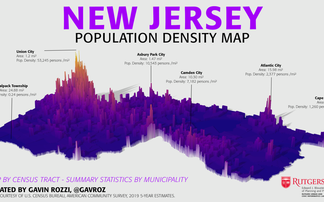
This map, created by Gavin Rozzi, showcases the diverse population density of New Jersey communities at the Census tract level through the use of 3D visualization techniques and selected annotations of municipalities. It took first place in NJDEP’s 34th Annual GIS...
