The field of healthcare administration is concerned with better patient care and healthcare delivery. The RUCI Lab is interested in using emerging technologies and novel sources of data for analytics to improve upstream determinants of health such as transportation...
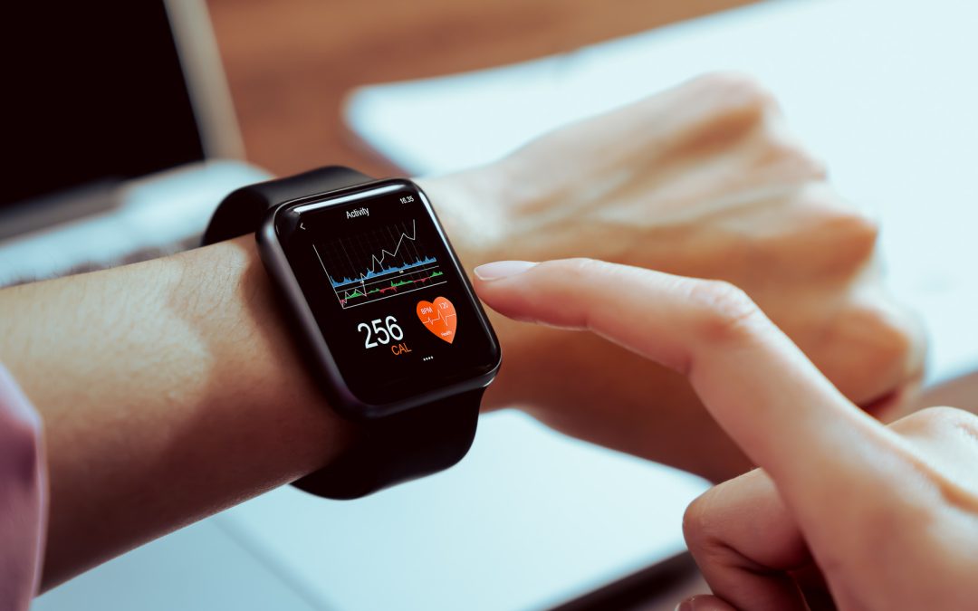
Recent increases in the use of wearable technology has opened up many new avenues of research. There are now vast numbers of wearable devices on the market which are used to record fitness and other leisure activities, monitor personal health and safety, and for...
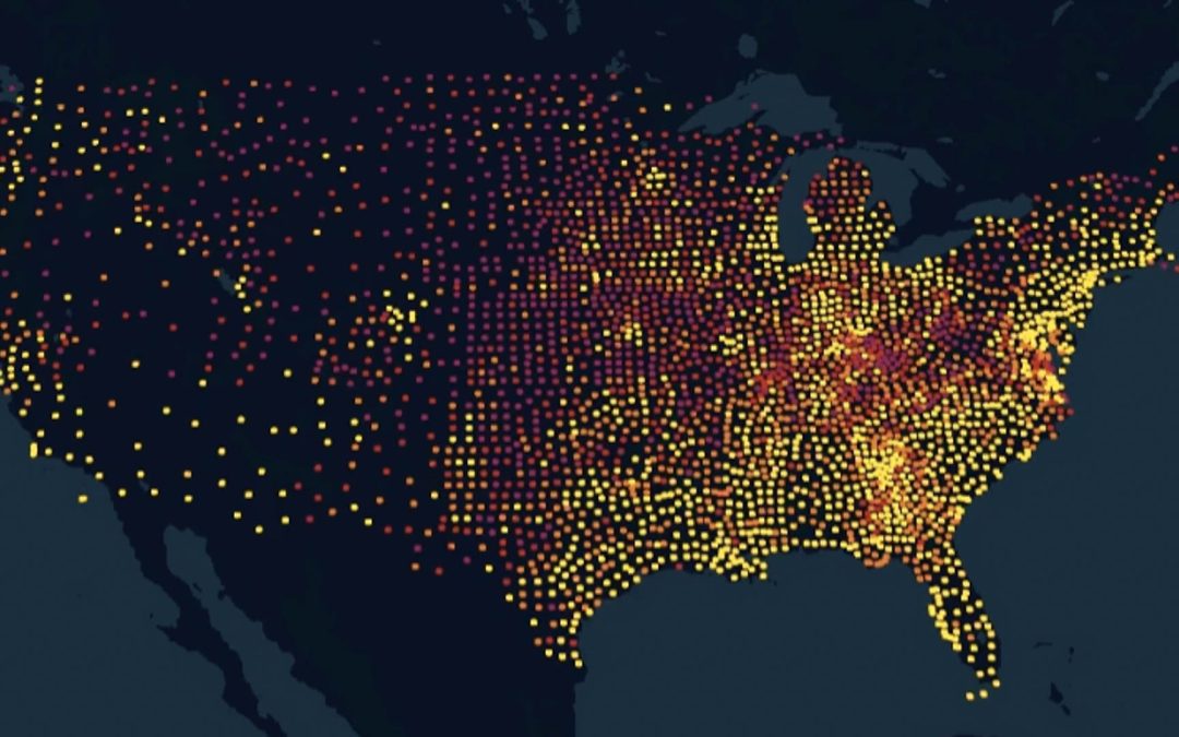
A lot has changed in New Jersey since the beginning of COVID. Dr. Vonu Thakuriah and RUCI Lab researchers have used a variety of data sources to track how places and people’s movements are changing over time, as we move beyond the health emergency. Based on cell phone...
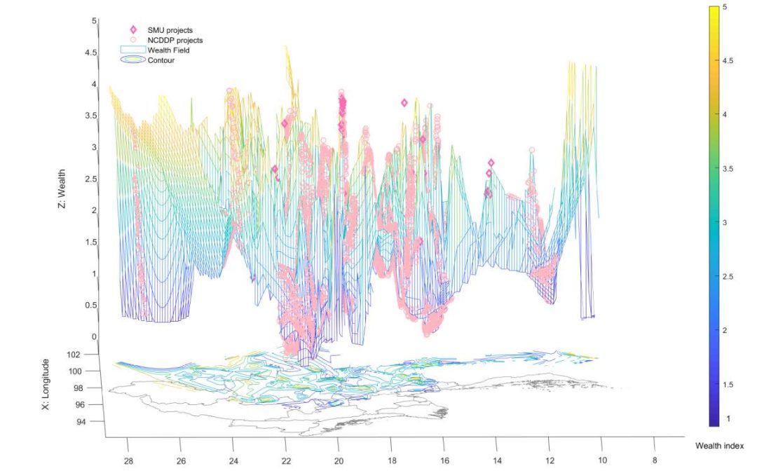
Woojin Jung, Assistant Professor at the Rutgers School of Social Work, and RUCI Lab Faculty Affiliate, is focused on utilizing geospatial data analytics, with a particular emphasis on poverty alleviation analytics in developing countries and communities. This body of...
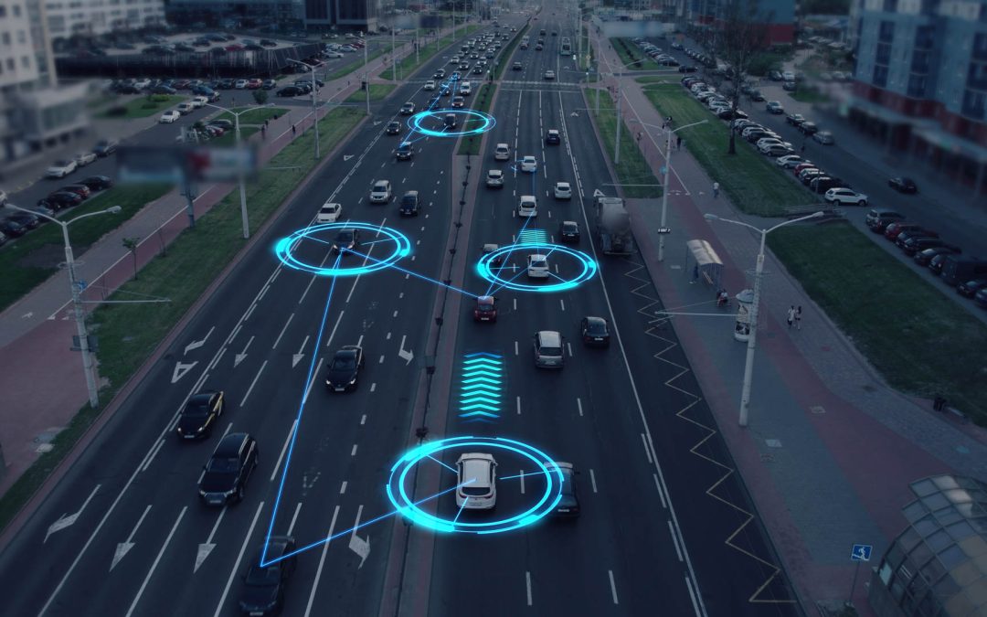
RUCI Lab Research Affiliate Dr. Wenwen Zhang is an Associate Professor in Informatics in the Edward J Bloustein School. Her research primarily focuses on the potential impacts of new and emerging transportation technologies, particularly Autonomous Vehicles (AVs)....
The principals in the Lab have domain expertise and experience in a number of research areas of relevance to cities, civil society and government. These are transportation, environment, energy, and the medical sciences. The proliferation of new forms of data have...
Event detection or identifying disruptions in the city’s economic, social or behavioral patterns are of great interest in Urban Informatics. Social media data offers the potential to understand trends and patterns, real-time monitoring of disruptions and events, as...
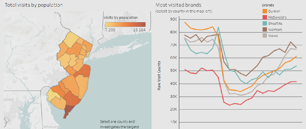
As a part of the RUCI Lab’s ongoing research into the social, economic and public health impacts of the COVID-19 pandemic in New Jersey through the use of data analytics, we have created an interactive dashboard that focuses on how foot traffic to local businesses has...
The New York Times created a public dataset tracking the spread of COVID-19 by county since the beginning of the year. This national, county-level dataset is a valuable resource for researchers and is a result of the collaborative effort journalists working across the...
The RUCI Lab’s project “CES-COVID19” is a cyberinfrastructure that captures real-time or close-to real-time data on social and economic effects of COVID-19, and brings data streams on different sectors together to support decision-making by local and regional...